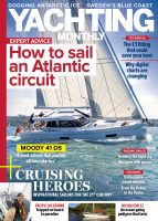
James Stevens considers a problem sent in by a Yachting Monthly reader who asks whether they should risk a short cut on a sailing passage
George and Janet are on holiday in North Brittany on board their 10m yacht, Roller Coaster. North Brittany has a spectacular coastline with numerous offlying rocks which are up to four miles offshore and many of them are hidden at high water.
The tidal range is huge; George and Janet are currently moored in Tréguier, where the range of the spring tide is just under 10m. Outside, the streams run at up to 4 knots offshore and 3 knots inshore between the rocks.
Roller Coaster is a fin-keeled production yacht with a draught of 1.7m. She is well equipped with an electronic chart system at the steering position but no radar.
George and Janet are planning to sail to Lézardrieux, about 20 miles to the east. The wind is fair, about 10 to 15 knots from the northwest, and the visibility is about half a mile. The tidal streams are favourable from about HW minus 3 hours to HW plus 3 hours.
There is an inshore passage which makes the trip shorter. It is well marked with two transits, one from the entrance of Tréguier river and another from the entrance of the river to Lézardrieux. There are also several buoys and posts. The passage passes over a 0.5m patch and at times within about 200m of the rocks either side.
Should they take the inshore passage or is taking the long way the sensible option?

Should you risk a short cut on a sailing passage?
Before GPS and electronic chart plotters the answer to this question would definitely be to go the long way round. Sailing through the rocks of North Brittany with a three-knot tide on a lee shore without having enough visibility to see the transit would be simply reckless.
However there are still hazards to consider, even when using the electronic chart.
When the transit markers were fixed, it was done by eye and therefore the transits are certain to work. The electronic course depends on the accuracy of the hydrographer. While we can expect the chart to be pretty accurate, the area will have been surveyed many years ago, in this case in 1837.
The GPS position, which is accurate to about 10 metres, could give a more precise latitude and longitude on the earth’s surface than the position of the rocks on the chart, especially outside the main channels. If you are unlucky the GPS signal can be downgraded by solar storms or radio interference.
I do think it’s possible to make the passage in half-a-mile visibility, but my preference would be to take the long route using the strong favourable tidal stream. Following the course on the electronic chart involves the helm spending most of the time staring at the screen instead of looking outside the yacht.
Once you take your eye off the sea all sorts of uncharted hazards such as lobster pots and small craft have to be spotted by the crew, thus slowing down the avoidance decision.
Enjoyed reading this?
A subscription to Yachting Monthly magazine costs around 40% less than the cover price, so you can save money compared to buying single issues.
Print and digital editions are available through Magazines Direct – where you can also find the latest deals.
YM is packed with information to help you get the most from your time on the water.
-
-
- Take your seamanship to the next level with tips, advice and skills from our experts
- Impartial in-depth reviews of the latest yachts and equipment
- Cruising guides to help you reach those dream destinations
-
Follow us on Facebook, Twitter and Instagram.

Leave a Reply